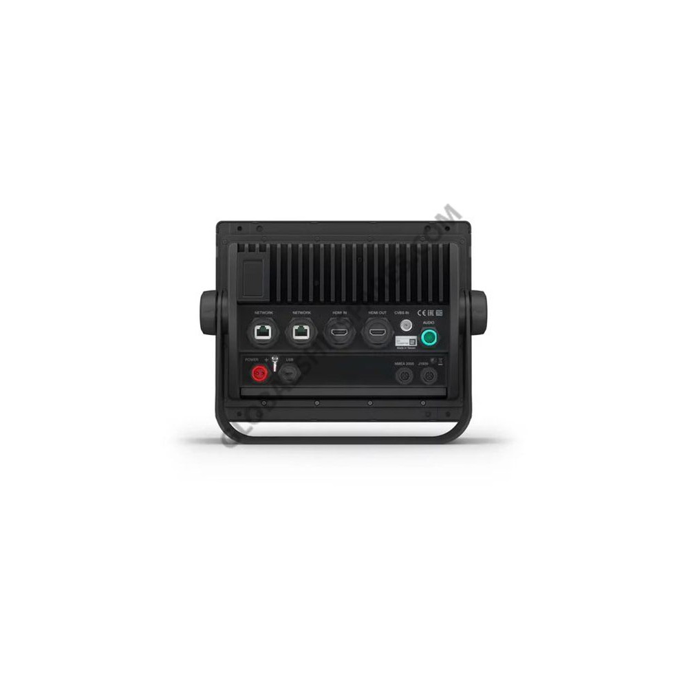
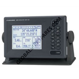
+65 6909 8211/13, info[at]globalshipspares[dot]com (Asia)

info-europe[at]globalshipspares[dot]com (EU)

Garmin GPSMAP® 8410 With Worldwide Basemap

Item Code:
010-02091-00
Brand:
Garmin
Condition:
New product
10” Touchscreen Chartplotter with Full HD In-plane Switching (IPS) Display
Features a 10” full HD IPS touchscreen display
Fully network capable with NMEA 2000® connectivity and the Garmin Marine Network
Includes ANT® technology and Wi-Fi® networking
Garmin SailAssist™ feature provides critical sailing data and displays prerace guidance for racers
SmartMode™ station controls enable quick, one-touch access to the information you need                                     
Serious cruisers, sailors and sail racers demand serious equipment. The easy-to-use, easy-to-install GPSMAP 8410 chartplotter delivers MFD performance in a combo-size package. It features a 10” full HD IPS touchscreen display for wider viewing angles, superior clarity and sunlight readability, even with polarized sunglasses. Multiple displays can be flat mounted edge-to-edge to create a sleek glass helm look or can be mounted flush. It also provides standard USB touch output for use as a touchscreen monitor for Windows® and Mac® operating systems.
Product Details
010-02091-00
Related products
GP150D
Furuno marine electronics including this GPS model are considered very accurate and reliable equipment worldwide for the navigation of virtually any type of vessel.
LJR-7700MK2
JLR-7700Mk2 DGPS navigator pinpoints your precise location by means of a simultaneous reception of 12 satellites The DGPS navigator composed of a DGPS receiver and a LCD display unit ensures very accurate position fix.
MX510
The MX510 is a versatile navigation system that offers extraordinary capabilities, with its multi-port interface that can be connected to ECDIS, ARPA, Gyro and other navigation information systems. Optional software...
010-02091-01
10” Touchscreen Chartplotter with Full HD In-plane Switching (IPS) Display Features a 10” full HD IPS touchscreen display preloaded with both BlueChart® g3 U.S. coastal and LakeVü HD maps featuring Navionics® data...

Menu

Account